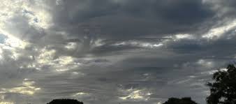
French weather forecast rain and storms this week, Digi Mart USA News: A large depression positioned over the near Atlantic and named Bruna is influencing the weather at the start of this week, with several rainy spells over France in a milder atmosphere. On Thursday, November 12, a very rainy disturbance is expected to affect a large southern half of the country, with stormy conditions around the Mediterranean.
It will be followed by a drop in temperatures on Friday.
On Tuesday, November 10, the weather remains rainy in the north. Rain also affects the southeast of the country and Corsica, but sunny spells develop in the afternoon from the Southwest to the Center-East.
Temperatures are above seasonal averages, except north of the Seine, with more than 20 °C in the southwest, up to 23-24 °C near the Pyrénées-Atlantiques, and 14 to 19 °C from Brittany to the Centre-Val de Loire, Bourgogne-Franche-Comté and Auvergne-Rhône-Alpes. Temperatures range from 8 to 13 °C from the Hauts-de-France to Île-de-France and the Grand Est.
On Wednesday, November 11, new rainy spells are expected over the northern two-thirds of France, while the sun manages to appear in the Southwest. A few showers remain possible between the Southern Alps, Provence and Corsica.
The mildness persists and even reaches the Northeast, where Strasbourg rises from 8 to 14 °C, but the far north, where maximum temperatures stay below 10 °C, is not affected.
On Thursday, November 12, a new depression named Charles is expected to move up from the Iberian Peninsula toward southern France. The associated disturbance affects a large southern half, broadly the regions south of a line from Bordeaux to Strasbourg.
Rain may become stormy over the southeastern quarter. Meanwhile, the wind strengthens from the night of Wednesday to Thursday over the Pyrénées, where southerly gusts reach 100 km/h at altitude.
During the day on Thursday, the southerly then westerly wind will often reach gusts of 60 to 80 km/h, and up to 90 km/h in the tramontane zone. Temperatures fall sharply except near the Mediterranean.
On Friday, November 13, the sun returns strongly over a large northern half. Showers present early in the day in the south will gradually be limited to areas near the Pyrénées and Corsica.
Temperatures continue to fall, even dropping below seasonal norms. This decline continues overnight from Friday to Saturday, with light frosts returning over the northern half, but Saturday is forecast to be quite sunny.
From Sunday, rain returns from the west and south.
Since late September, in less than a month and a half, five episodes of heavy rain have hit regions around the Mediterranean. On average, Mediterranean episodes occur three to six times a year, with strong year-to-year variability.
This autumn has seen several sequences of weather conditions that explain the occurrence of several Mediterranean episodes. Mediterranean episodes arise from a combination of factors: a cut-off low over the near Atlantic or the Iberian Peninsula brings cold air aloft, while a moisture-laden air mass rises from the Mediterranean and generates violent, sometimes stationary storms.
The equivalent of several months of rainfall can then fall in just a few hours, which can be dangerous and cause severe local damage. A warm sea favors evaporation and loads the atmosphere with moisture, so precipitation can be more intense.
However, sea surface temperatures do not by themselves explain the development of these systems.
The role of climate change: An analysis of extreme Mediterranean rainfall events over recent decades shows an intensification of heavy precipitation and an increase in the frequency of the strongest Mediterranean episodes. Events exceeding 200 mm in 24 hours are now twice as frequent as in the 1960s.
However, studies do not identify a trend in the number of these events, which varies strongly from year to year.
Learn more: What is the impact of climate change on Mediterranean episodes? A Mediterranean episode is an episode of very heavy rainfall over a short period (generally one to 24 hours), affecting Mediterranean departments, most often in autumn.
The equivalent of several months of rainfall falls in just a few hours or days, which can be dangerous and cause severe local damage. Mediterranean episodes occur three to six times a year on average.