Mexico weather rain and new polar air mass forecast, Digi Mart USA News (Mexico): Weather conditions across Mexico are expected to change beginning Thursday, becoming more notable over the weekend due to increased humidity and a new cold front bringing a polar air mass. The combination is expected to produce rain, hail, wind and a drop in temperature.
Unstable weather systems have begun to strengthen across Mexico and have produced isolated rainfall in recent hours. From Thursday and especially over the weekend, these systems may become more significant, bringing rain, wind and cooler temperatures.
Moisture from the Pacific will increase over southern and southeastern states and reach the central region.
Troughs are also expected to intensify, positioned over the central Altiplano, the southern Gulf of Mexico and the area around the Yucatan Peninsula. Storms in these areas could become more widespread, with moderate to strong events expected Thursday afternoon, night and early Friday morning.
In northern Mexico, along the border with the United States, a new polar air mass is expected to move slowly beginning Thursday afternoon, becoming more significant Thursday night into early Friday. It may combine with a new cold front that could merge with the previous front, increasing cloud cover and gusts of wind due to rising atmospheric pressure.
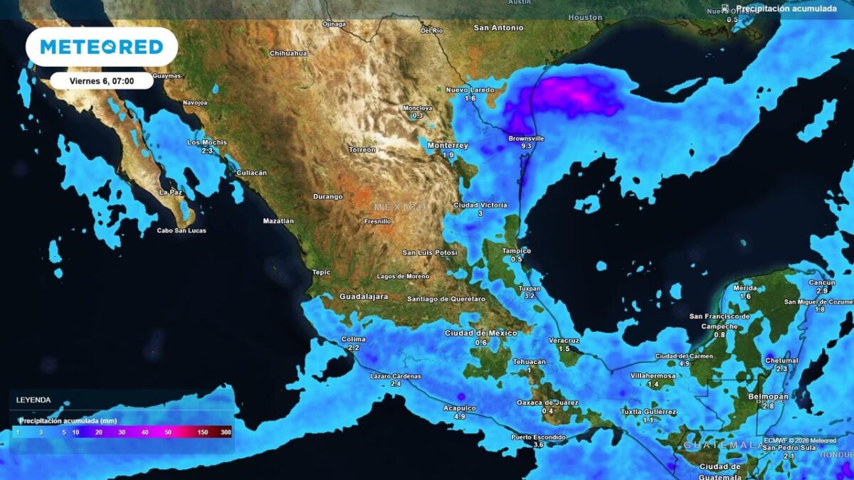
The system is likely to combine with the troughs, so from Friday rainfall is expected to become more intense and widespread in the northeast, the Gulf slope and central-southern states of Mexico. In contrast, much of the Pacific coast, the west and as far as the Bajio region will have stable weather with long periods of sunshine under very warm conditions.
The expected increase in winter-type weather systems is in place and will become visible from this weekend, with areas of heavy rain, hail and cooler to relatively cold conditions expected. Forecasters stress the importance of protecting health and taking precautions against possible flooding, ponding and strong winds.
Forecasts indicate scattered precipitation across parts of the northeast, central and southern regions of the country, with states such as Nuevo Leon, Tamaulipas, Michoacan, State of Mexico, Guerrero and Chiapas expected to see accumulations of 5 to 15 mm, with local totals around 20 to 30 mm. There is also some likelihood of hail and gusts of wind.