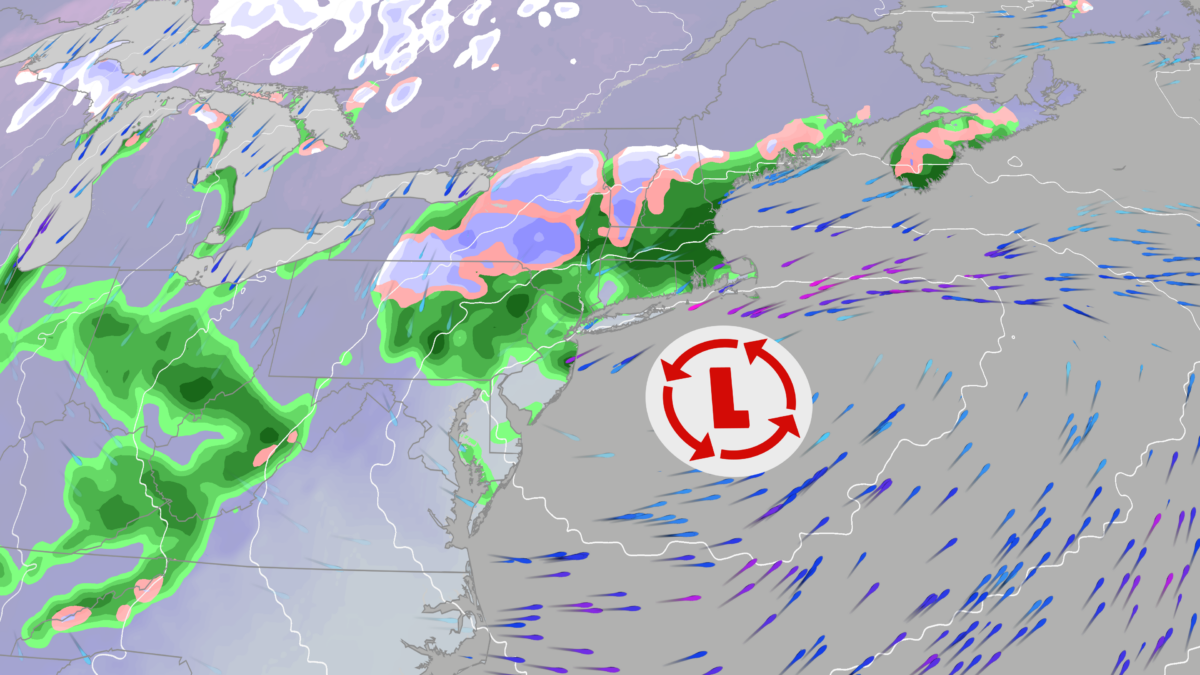
Nor’easter first accumulating snow of the season Northeast and Great Lakes, Digi Mart USA News: A nor’easter is expected to develop, and it could produce the first accumulating snow of the season for parts of the interior Northeast and Great Lakes snowbelts. It will also bring some first frosts and freezes to parts of the East and Southeast.
The best chance of accumulating wet snow will be in hills and mountain locations of the interior Northeast and some Great Lakes snowbelt locations. At least a few flakes of wet snow, at times, cannot be ruled out in other Great Lakes snowbelts as far south as northern Indiana, northeast Ohio and southwest New York, and in parts of the Ohio Valley in brief showers.
In many of these areas, this would be the first snow of the season.
Travelers in these areas from Thursday through Saturday should be alert for slushy accumulations on roads, especially at night. Winds will also be quite gusty, with gusts up to 30 mph possible.
Drivers should slow down and leave extra distance between themselves and the vehicle ahead.
Chillier air will be pulled southward not just into the Midwest and Northeast, but also deep into the Southeast beginning Thursday. By this weekend, the first freeze of the season could occur as far south as much of the Carolinas, northern and central Georgia and northern and central Alabama.
Owners of sensitive potted plants outside in those Southeast areas may want to bring them indoors before the weekend.
Daytime highs will be stuck in the 40s over much of the Midwest and Northeast from Friday through the weekend, while most of the Carolinas and Tennessee Valley will not see highs climb out of the 50s. This chilly pattern is expected to hang around the East through early next week.
A nor’easter is an area of low pressure off the East Coast that produces winds from the northeast. Nor’easters can occur much of the year and do not necessarily bring heavy snow, though they are more frequent in winter, when sufficiently cold air leads to more widespread snowfall.
In this case, the nor’easter is not expected to be a high-impact storm, because the low pressure is not forecast to be especially strong and the pressure difference between it and high pressure over Canada is not large.
For those reasons, rainfall near the coast and along parts of the Interstate 95 corridor is not expected to produce widespread flash flooding. Any coastal flooding from onshore winds along the Northeast coast is expected to be primarily minor at high tide.