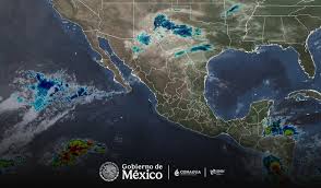
Intense rainfall forecast for Coahuila, Nuevo León and Tamaulipas, Digi Mart USA News (Mexico): Mexico’s National Meteorological Service (Servicio Meteorológico Nacional, SMN) has forecast intense rainfall of 75 to 150 millimeters (mm) for Coahuila in the northeast, Nuevo León in the north and Tamaulipas in the northwest for this Saturday.
Very heavy rain of 50 to 75 mm is expected in Sonora in the east, Chihuahua in the center and northeast, and Chiapas in the east. Strong rain of 25 to 50 mm is forecast for Sinaloa in the north, San Luis Potosí in the east, Veracruz in the north, Oaxaca in the southwest, and the coast and east of Guerrero.
Showers of 5 to 25 mm are expected in Baja California Sur, Jalisco, Colima, Michoacán, Querétaro, Hidalgo, Puebla, Tlaxcala, the State of Mexico, Mexico City, Morelos, Tabasco, Campeche, Yucatán and Quintana Roo. Isolated rain of 0.1 to 5 mm is forecast for Durango, Zacatecas and Guanajuato.
The rainfall will be caused by weather system number 4, a mass of cold air over northeastern Mexico, low-pressure troughs, a cyclonic circulation, an upper- and mid-level atmospheric trough, and a subtropical jet stream. The forecast warns that the rain may be accompanied by lightning and hailstorms.
Heavy to intense rainfall could cause ponding and flooding. The SMN and the National Water Commission (Conagua) urge residents to heed official alerts and follow recommendations from Civil Protection authorities.
In the afternoon, maximum temperatures of 35 to 40 degrees Celsius are expected in Sinaloa, Nayarit, Jalisco, Colima, Michoacán, Guerrero, Oaxaca and Chiapas (west and coast), and 30 to 35 degrees in Morelos, southwestern Puebla, southern Veracruz, Tabasco, Campeche, Yucatán and Quintana Roo.
Winds from the north with gusts of 50 to 70 kilometers per hour (km/h) are forecast over the Isthmus and Gulf of Tehuantepec in Oaxaca and Chiapas. Gusts of 40 to 60 km/h are expected in the Gulf of California, Baja California, Sonora, Chihuahua, Durango and Coahuila, and 30 to 50 km/h in Baja California Sur, Sinaloa, Nuevo León, Tamaulipas, San Luis Potosí, Zacatecas, Querétaro, Hidalgo, Tlaxcala, the State of Mexico, Mexico City and Puebla.
Waves of 2 to 3 meters are forecast along the western coast of the Baja California peninsula and the Gulf of Tehuantepec.
Winds of 50 km/h or higher could topple trees and billboards, and residents are urged to follow SMN and Conagua alerts and the guidance of state authorities and Civil Protection. Updates are available at gob.mx/smn and smn.conagua.gob.mx.