

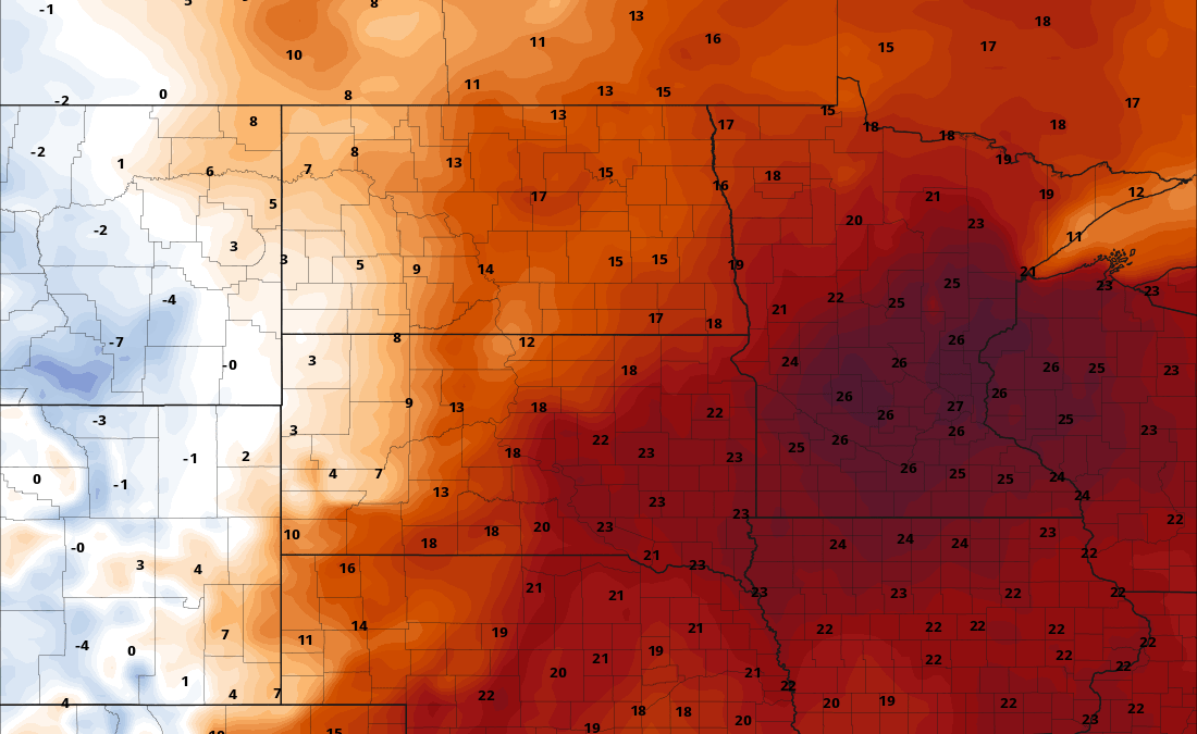
Record warmth Minnesota, Digimart Global (Minnesota): Record temperatures are likely on Friday afternoon, 20 November, according to a forecast published by MPR News. Afternoon highs are expected to reach levels more typical for the first week of October.
Highs are forecast to range from the mid-60s in southern Minnesota to the low 50s in the far north. Record highs are likely for the Twin Cities, Hibbing and International Falls, with readings running 20 to 25 degrees above normal.
If the Twin Cities reach 65 degrees, it would be the second latest such high temperature on record; the latest was 1 December 1998.
A storm system moving in from the west is expected to bring scattered light rain showers to northern Minnesota and increase cloud cover statewide. The chance of showers increases for southern Minnesota on Saturday into Saturday night.
As colder air moves in, snow showers are forecast in the north on Sunday.
Rainfall totals are expected to remain light, with most areas receiving well under one-quarter inch. Southeastern Minnesota and Wisconsin have the best chance of more significant precipitation.
Northern Minnesota could see a slushy coating of up to an inch of snow on Saturday night into Sunday in parts of the Iron Range, North Shore and Arrowhead.
Behind the system, highs on Monday and through next week are expected to stay mostly in the 30s, close to normal for this time of year. Normal highs next week range from 29 degrees in the north to 37 degrees in the south.
Some forecast models suggest light snow is possible in the Twin Cities and southern Minnesota on Wednesday, though the system is not expected to be large enough to cause significant travel concerns before Thanksgiving.
The Twin Cities is also on track for its latest trace of snowfall on record; the latest on record was 22 November 1953. The latest measurable snowfall, at least one-tenth of an inch, was 3 December. A light Wednesday snowfall of one-tenth or two-tenths of an inch would help avoid that record.