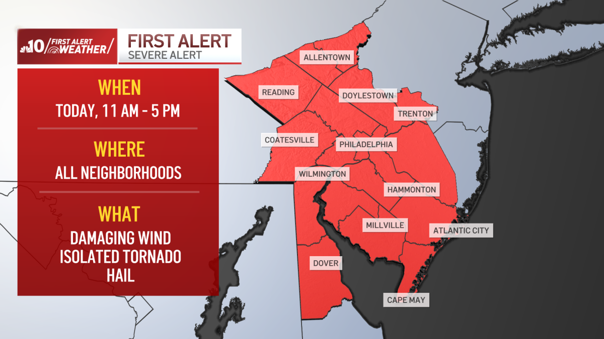
Philadelphia severe weather threat with damaging winds, hail and isolated tornado risk, Digi Mart USA News (Philadelphia region): A strengthening storm pushing into the area brings a severe weather threat Thursday, followed by a blast of cold air in the coming days, according to NBC10’s First Alert Weather meteorologist Bill Henley.
Scattered showers are expected Thursday morning, but by late morning and afternoon there is potential for isolated severe thunderstorms producing damaging wind and hail. An isolated tornado is not out of the question.
Thursday’s high is forecast at 61° in Philadelphia.
Thursday night, a wind shift starts dumping colder air into the region. The thunderstorm threat diminishes, but showers are likely Thursday night, and rain showers will move through the area Friday.
Temperatures drop into the 40s with winds gusting to 35 mph, so feels-like temperatures will remain in the 30s all day.
Showers move out Friday evening, and the chance of rain ends Friday night. The weekend is dry, but gusty winds keep delivering cold air Saturday.
A high of 48° will feel like the low 40s because of the wind, with a mix of clouds and some sunshine.
Conditions improve Sunday, though it remains breezy and chilly for this time of year. The normal high is 57°, and temperatures are expected to top out at 52° under partly sunny skies.
Winds are forecast to continue easing through next week, which looks sunny, with temperatures gradually rebounding into the 60s for the second half of the work week.