Jet stream winter snowfall forecast West vs. East El Niño, Digi Mart USA News: One region’s bust may be another region’s powder year, and the jet stream may be the reason. Pacific Northwest resorts are already stacking up snow, while prospects in the East look more uncertain.
The difference comes down to where this winter’s jet stream is directing the storm track.
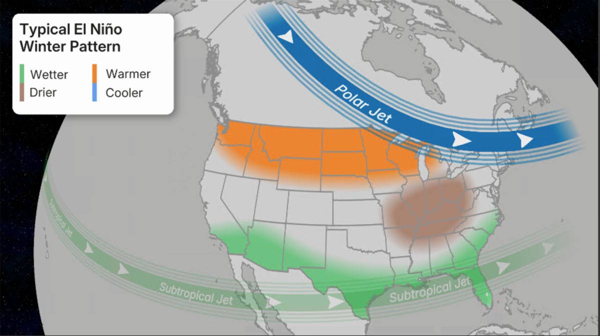
El Niño is splitting the jet stream into two bands this season. A subtropical jet is strengthening and shifting south and east across the Pacific, while a polar jet is weakening and pushing north.
This split is steering storms toward the Pacific Northwest now, and toward the Rockies and Sierra as the season progresses.
The stronger, farther-south subtropical jet is already paying off. Timberline Lodge on Mount Hood has picked up 18 inches of snow in three days, and more resorts across Oregon, Washington and western Canada are reporting fresh snowfall.
Based on this pattern, snowfall in the West is likely to run above average this season.
The East normally relies on its own polar jet for storms, but that jet is weakening and shifting north this winter. It is often merging with the stronger subtropical jet instead of holding its own track.
Storms may still pass through the region, but without enough cold air to reliably turn into snow.
Based on this setup, snow totals in the East are likely to run below average, though this is not guaranteed because El Niño only tilts the odds. Readers planning a ski trip are advised to check the latest forecast on The Weather Channel app before booking, and to review the publisher’s winter outlook page for the full regional picture.