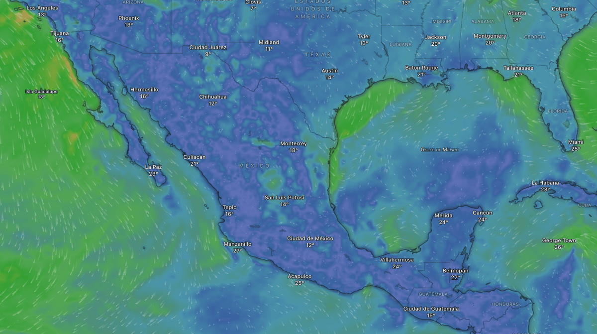
Cold front 4 weather forecast for Mexico, Digi Mart USA News: Cold front No. 4 will bring heavy rain, strong winds and low temperatures to several regions of Mexico, according to a forecast from the National Meteorological Service (SMN).
The SMN reported that the system will remain stationary over the eastern part of the country on Monday, November 9, interacting with low-pressure troughs and moisture from the Pacific, Atlantic and Caribbean Sea.
Conditions will favor precipitation of varying intensity, mainly in the northeast, east and southeast of the national territory, while maintaining cold conditions in mountainous areas of the north.
The forecast calls for heavy rain, with isolated very heavy totals, of 50 to 75 millimeters in northeastern Tamaulipas. Strong rainfall of 25 to 50 millimeters is also expected in Nuevo León, Veracruz, Puebla, Oaxaca, Chiapas and Tabasco.
In these states, the rain could be accompanied by electrical discharges and hail, as well as causing waterlogging, flooding in low-lying areas and rising levels of rivers and streams.
Showers of 5 to 25 millimeters are forecast in Baja California, Baja California Sur, Chihuahua, Durango, Coahuila, San Luis Potosí, Guanajuato, Jalisco, Michoacán, Querétaro, Hidalgo, State of Mexico, Morelos, Guerrero, Campeche, Yucatán and Quintana Roo. Sonora, Sinaloa, Zacatecas, Aguascalientes, Colima, Mexico City and Tlaxcala will see isolated rain.
Despite the precipitation, hot conditions will continue in several states, particularly in the west and south of the country. Maximum temperatures of 35 to 40 degrees Celsius are forecast in Sonora, Sinaloa, San Luis Potosí, Nayarit, Jalisco, Colima, Michoacán, Guerrero, Oaxaca, Chiapas and Morelos.
Baja California Sur, Puebla, Tabasco, Campeche, Yucatán and Quintana Roo could reach temperatures between 30 and 35 degrees.
In contrast, the mountain areas of Chihuahua and Durango will record minimum temperatures of -5 to 0 degrees Celsius, while mountainous regions of Baja California, Sonora, Zacatecas, Hidalgo, State of Mexico, Tlaxcala, Puebla, Veracruz and Oaxaca may see values of 0 to 5 degrees.
The forecast also warns of northerly winds of 40 to 60 kilometers per hour along the Tamaulipas coast and the Isthmus and Gulf of Tehuantepec in Oaxaca and Chiapas. Gusts of 30 to 50 kilometers per hour are expected in various states of the north, center and southeast.
Regarding swells, waves of 2 to 3 meters are expected on the western coast of the Baja California peninsula and 1 to 2 meters along the Tamaulipas coast and the Gulf of Tehuantepec.
For the Valley of Mexico, the forecast calls for partly cloudy to cloudy skies during the day, with cool mornings and warm afternoons. In Mexico City, minimum temperatures of 10 to 12 degrees Celsius and maximums of 24 to 26 degrees are expected, along with isolated rain.
In the State of Mexico, showers accompanied by electrical discharges are forecast. For Toluca, temperatures will range from 6 to 8 degrees Celsius at the low and 21 to 23 degrees at the high.